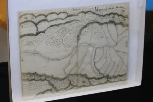
Centuries-old map displayed at a ceremony held
on September 23, 2025, in Albuquerque, celebrating
its return to Mexico’s national archives (AP Photo
by Susan Montoya Bryan)
In 2011, archivists in Mexico City discovered that a 16th century map of the Villa de Santa Fe was taken from the national archives. About five years had passed, when a librarian at the Fray Angélico Chávez History Library at the New Mexico History Museum in Santa Fe was doing research on a map that was presented to the library for sale. According to Billy Garrett, executive director of the museum, the librarian found evidence that the map may have been stolen. Once proven the document was genuine, it took several more years to navigate through international protocols and laws before the FBI was finally able to hand over the historic map to Mexican officials, during a ceremony held on September 23, 2025, at the Mexican Consulate in Albuquerque, New Mexico.
The map, which was produced on paper made of rag pulp, was among 75 pieces that were taken from records belonging to the national archives. Federal investigators have not divulged any details about the investigation, but have indicated that no charges will be filed. (Susan Montoya Bryan, Associated Press, September 24, 2025, https://apnews.com/article/spanish-colonial-map-mexico-history-b13db985c97a3a3f11285d94008bd22c.)